Helicopter Flight Time Calculator for Nepal Routes
Go Heli Nepal9 min read
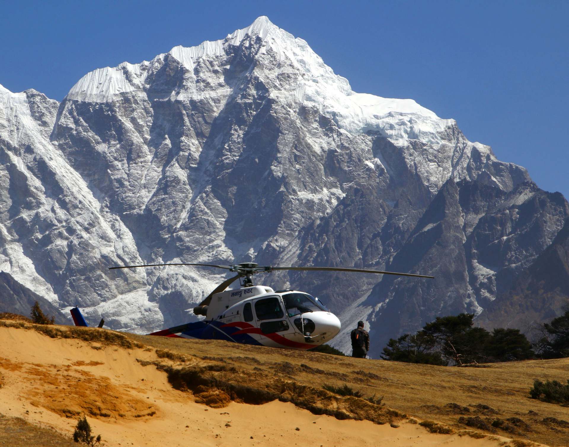
Photograph: © NPS Staff / Wikimedia Commons · public domain
Distance over cruise speed is the first step and not the answer. How to work out a helicopter flight time in Nepal, and the two corrections it needs.
A helicopter flight time for a route in Nepal is the great-circle distance between two landing sites divided by the aircraft's published cruise speed, then corrected for the climb and for the sectors the aircraft actually flies. Four inputs produce it: two sets of surveyed coordinates, a cruise speed in knots, the elevation gain in metres, and the refuelling stops on the way. The result is air time, which is not the time a charter is quoted at.
1. Take the straight-line distance between the two landing sites. It is the great-circle distance computed from each site's surveyed latitude and longitude, and Go Heli Nepal's flight-time tool uses an Earth radius of 3,440.065 nautical miles to produce it, the same constant the operations database uses.
2. Divide that distance by a cruise speed you can name the source of. Go Heli Nepal publishes 120 knots for the H125, the type that does most of the high-altitude work in Nepal's Khumbu. Airbus gives the same type a fast cruise of 136 knots, or 252 km/h, on its technical information page.
3. Add the sectors you are not counting. A Khumbu flight from Kathmandu refuels at Lukla on the way out and again on the way back, so the aircraft flies four legs where the endpoints suggest two.
4. Check the elevation gain against the aircraft's published rate of climb. A leg that asks for a large share of it is a leg the division underestimates, because the aircraft spends most of it at climb speed rather than cruise speed.
5. Add the ground time separately, and keep it separate. Check-in, weighing, the weather briefing, the fuel stop and the minutes on the helipad at the far end are not flying, and they are in nobody's flight-time figure.
What comes out is a planning number with its assumptions visible. That is the most any calculator can give you in this country, and it is more than a single quoted duration gives you.
Which numbers do you need before you can calculate anything?
Two coordinates, one cruise speed and two elevations. Nothing else in the calculation is an input.
The coordinates have to be surveyed rather than approximate, because a Himalayan helipad a kilometre out of position changes the answer by a minute. Tenzing–Hillary Airport at Lukla, the nearest aerodrome to Everest and the refuelling point for almost every helicopter movement in the Khumbu, sits at 27.6869° N, 86.7311° E and 2,845 m. Kathmandu's Tribhuvan International Airport, where most of Nepal's helicopter fleet is based, sits at 27.6966° N, 85.3591° E and 1,338 m. Kala Patthar, the ridge the Everest tour lands on, sits at 27.9955° N, 86.8281° E and 5,545 m.
The cruise speed has to come from somewhere nameable. Go Heli Nepal's 120 knots for the H125 is a figure for the fleet as operated; Airbus publishes 136 knots as the same type's fast cruise; GlobalAir gives the Bell 412EP a maximum cruise of 122 knots. All three are quoted at low altitude in standard air, which is why a calculated time is a band rather than a number.
The elevations do two jobs. They give the climb, which step four needs, and they tell you which end of the leg is the one with a performance problem.
| Leg | Straight line | Air time at 120 kt | Elevation gain |
|---|---|---|---|
| Kathmandu – Lukla | 72.94 nm · 135 km | 37 min | 1,507 m |
| Kathmandu – Namche Bazaar | 72.30 nm · 134 km | 37 min | 2,102 m |
| Kathmandu – Kala Patthar | 80.02 nm · 148 km | 41 min | 4,207 m |
| Lukla – Kala Patthar | 19.23 nm · 36 km | 10 min | 2,700 m |
Great-circle distances between the coordinates this site publishes for each site, at the 120 knots Go Heli Nepal publishes for the H125. A helicopter follows the valley rather than the line, so each distance is the shortest the leg can be.
How long is the helicopter flight from Kathmandu to the Everest region?
Forty-one minutes of air time one way on the arithmetic, and about an hour as operators in Nepal actually fly it.
Kala Patthar is 80.02 nautical miles from Kathmandu in a straight line — 148 km, east. At 120 knots that is 41 minutes. The published itineraries do not say 41 minutes, and they are not wrong.
One Kathmandu operator's own listing gives the distance between Gorak Shep, in the upper Khumbu beside Everest Base Camp, and Kathmandu as about 151 km and the flight as 65 minutes. Those two numbers together work out at roughly 75 knots over the ground, against the 120 knots the same fleet's aircraft are credited with. The gap is not an error in either figure. It is everything the straight line leaves out.
So the honest answer to the question has two halves. The air time between the endpoints is 41 minutes. The sector you are sold is quoted at around an hour, and the day it sits inside runs to about four hours on the operator itineraries that publish one.
Why is the sum of the sectors longer than the distance between the endpoints?
Because the aircraft stops at Lukla for fuel, twice, and a point-to-point calculator never sees it.
The operator itineraries for the Everest tour agree on the routing: Kathmandu to Lukla, refuel, on to the Everest viewpoint, back to Lukla, refuel again, Kathmandu. Flown that way the aircraft covers 72.94 nautical miles, then 19.23, then 19.23, then 72.94 — 184 nautical miles, or 341 km.
An out-and-back between the endpoints is 160 nautical miles, 296 km. The difference is 24 nautical miles, 45 km, about 15 per cent more flying than the two coordinates imply.
That 15 per cent is the single largest correction on this route, and it is the one every calculator gets wrong, because it is not a property of the distance at all. It is a property of where the fuel is. Fuel is available at only a handful of Nepali airfields, and Lukla is the one that matters in the Khumbu.
The rule generalises: calculate the sectors the aircraft flies, not the distance between the places you are going. On a route with no fuel stop the two are the same number. On a Khumbu route they are not.
| Measured as | Distance flown | Air time at 120 kt |
|---|---|---|
| Out and back between the endpoints | 160 nm · 296 km | 80 min |
| The four sectors actually flown | 184 nm · 341 km | 92 min |
The routing is the one operators publish themselves — Lukla outbound and inbound for fuel. The distances are great-circle legs between this site's surveyed coordinates.
When does the climb, rather than the cruise speed, set the flight time?
When the leg asks for a large share of the aircraft's published rate of climb. There is a test for it, and it needs one division.
Take the elevation gain in feet and divide it by the minutes the distance arithmetic gave you. That is the average rate of climb the leg demands. Then compare it with a published figure: Airbus gives the H125 a rate of climb of 1,959 ft per minute on its product page for the type, and GlobalAir's specification sheet for the AS350 B3e gives the same number.
Kathmandu to Lukla gains 1,507 m, which is 4,944 ft, across the 37 minutes the division allows. That is 134 ft a minute, about 7 per cent of the published rate. The climb is not the constraint and the arithmetic holds; operators quote the sector at 40 to 45 minutes against a calculated 37.
Lukla to Kala Patthar gains 2,700 m, which is 8,858 ft, across 10 minutes. That is 886 ft a minute, about 45 per cent of the published rate — on a leg a quarter as long. And 1,959 ft per minute is a sea-level figure in standard air, so the real margin at 4,000 m is smaller than the share suggests.
The published times bear it out. Operators quote Kathmandu to Lukla within a few minutes of the calculation, and quote Lukla to Kala Patthar at anywhere from 10 minutes to 25 minutes — the same leg, the same distance, a spread of two and a half times. That is what a climb-limited leg looks like in a brochure.
A rule of thumb falls out of it. Divide the metres gained by the kilometres flown: Kathmandu to Lukla climbs about 11 m per kilometre, Lukla to Kala Patthar about 75 m per kilometre. Past roughly 50 m per kilometre, stop trusting the division and ask the operator.
| Leg | Climb demanded | Share of 1,959 ft/min | Gain per km flown |
|---|---|---|---|
| Kathmandu – Lukla | 134 ft/min | About 7 per cent | 11 m |
| Lukla – Kala Patthar | 886 ft/min | About 45 per cent | 75 m |
The demanded rate is the elevation gain divided by the air time the distance arithmetic gives. The 1,959 ft per minute is the H125 figure Airbus and GlobalAir both publish, quoted at sea level in standard air.
What does a calculated flight time have to do with what you are billed?
Less than people expect, and the direction of the error is always the same one.
A Nepali charter is billed by the hour of block time or as a fixed price for a named sector, and block time is measured from engine start to engine stop rather than from take-off to landing. Go Heli Nepal's charter page puts a 55-minute sector at around 1.2 hours of block. A calculated air time is therefore the smallest of the three numbers in play, every time.
Three more things sit between the calculation and the invoice. Most Nepali operators set a daily minimum for committing an aircraft to a day, so a short leg can be billed at the minimum rather than at what it flew. Positioning is the empty flying needed to bring the aircraft to you and take it home, and you pay for it whether you ride it or not. A weather hold is carried by whoever the quote's shape says carries it — the customer under an hourly rate, the operator under a fixed sector price.
All of that is the rate model rather than the arithmetic, and it has its own page. What matters for a calculation is only this: the number you computed is air time, and nothing is billed in air time.
The flight itself runs under an operator's Air Operator Certificate from the Civil Aviation Authority of Nepal. Go Heli Nepal is a marketplace and holds no certificate, owns no aircraft and employs no pilots; the contract, the crew and the passenger liability cover belong to the operator whose name is on the invoice.
What can no calculator tell you about a flight in Nepal?
The ground time, and whether you fly at all.
The fuel stop at Lukla is the clearest case. Operators' own itineraries put it at 10 to 15 minutes in one listing and 25 minutes in another, which is a spread as wide as the Lukla to Kala Patthar leg itself. Nothing about the distance predicts which you get.
Weight can add a landing that is not on the route. Several Everest itineraries describe a stop at Pheriche to meet a weight limit before the high leg, and an itinerary that lists Lukla to Pheriche as 20 minutes over 25 km has added a sector the endpoints never mentioned.
Then there is the weather, which is not a correction factor. Lukla does not close for an hour, it closes for the day, and no operator in Nepal can promise a departure slot in the monsoon. A flight time calculated to the minute for a day the aircraft does not fly is an exact answer to the wrong question.
Which is the honest limit of the method. Distance over cruise speed, plus the sectors, plus the climb check, gives you a planning number you can defend and reproduce. The dispatcher's block time on the morning is the number the flight is quoted and flown against, and it is always the larger of the two.
FAQs
How do you calculate a helicopter flight time for a Nepal route?
Divide the great-circle distance between the two landing sites by the aircraft's published cruise speed, then add the sectors the aircraft actually flies and check the elevation gain against its published rate of climb. Go Heli Nepal publishes 120 knots for the H125, the type that does most of the high-altitude flying in Nepal's Khumbu, and computes distance from surveyed coordinates using an Earth radius of 3,440.065 nautical miles. The result is air time, which excludes the climb, the wind, any hold and every minute on the ground.
How long is the helicopter flight from Kathmandu to the Everest region?
Kala Patthar, the ridge the Everest helicopter tour lands on, is 80.02 nautical miles from Kathmandu in a straight line — 148 km — which is 41 minutes of air time at the 120 knots Go Heli Nepal publishes for the H125. Operators sell the sector at around an hour, and the whole day at about four hours, because the aircraft refuels at Lukla in both directions and spends time on the ground at each stop. No helicopter lands at Everest Base Camp; the landing on that tour is Kala Patthar, at 5,545 m.
Why is the flown distance of a Nepal helicopter route longer than the distance between its endpoints?
Because the aircraft stops for fuel, and the fuel stop is a sector of its own in each direction. Kathmandu to Kala Patthar and back is 160 nautical miles, or 296 km, measured between the endpoints. Flown the way operators publish it — Kathmandu to Lukla, on to the viewpoint, back through Lukla — it is 184 nautical miles, or 341 km, about 15 per cent more. Fuel is available at only a handful of Nepali airfields, and in the Khumbu that airfield is Lukla.
When does a helicopter's climb rather than its speed decide a flight time?
When the leg demands a large share of the aircraft's published rate of climb. Divide the elevation gain in feet by the minutes the distance arithmetic allows, then compare it with the 1,959 ft per minute that Airbus and GlobalAir both publish for the H125. Kathmandu to Lukla asks for 134 ft a minute, about 7 per cent of that. Lukla to Kala Patthar asks for 886 ft a minute, about 45 per cent, over a leg a quarter as long — which is why operators quote that one at anywhere from 10 to 25 minutes.
What does a helicopter flight time calculator leave out?
The ground time, the refuelling, any weight stop, and the weather. Operators' own Everest itineraries put the Lukla fuel stop at 10 to 15 minutes in one listing and 25 minutes in another, and several describe an extra landing at Pheriche to meet a weight limit before the high leg. A charter is billed in block time, measured from engine start to engine stop, and Go Heli Nepal's charter page puts a 55-minute sector at around 1.2 hours of it. A calculated air time is always the smallest number in the day.
Ready to fly this route?
The desk asks the licensed operators that fly it and brings their seat and whole helicopter prices back side by side.
See the route and prices